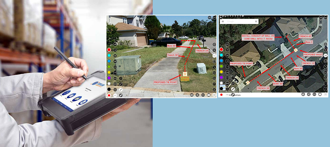
Mobile Field Survey
Centillion, with its in-depth experience in applying smart technologies innovatively to provide value-added solutions to our customers, brought smart field data collection services using the latest LiDAR tools to Telecom & Utility industries. Our commitment to leveraging advanced technology ensures precise data acquisition, enabling clients to make informed decisions quickly and efficiently.
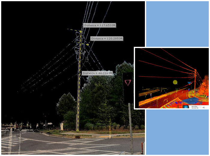
Mobile Mapping solution is best suited for road survey and corridor mapping because of its ability to capture extensive amounts of data at high speeds, drastically reducing the requirement for physical walkout, and need for multiple rounds saving both time and money.
Centillion offers end-to-end smart Field survey services employing Mobile, Terrestrial & Aerial LiDAR as required. Mobile Mapping solutions are best suited for road surveys and corridor mapping because of their ability to capture extensive amounts of data at high speeds, drastically reducing the requirement for physical walkouts and multiple rounds. This streamlined process saves both time and money while enhancing the accuracy and reliability of the collected data. Centillion offers end-to-end smart field survey services employing Mobile, Terrestrial, and Aerial LiDAR as required.
Service Offering
Centillion Solutions provides end-to-end Outside Plant Services, ensuring precise design and reliable maintenance of your infrastructure. Our robust Data Services specialize in Asset Data Management, enabling efficient decision-making and seamless project execution.
Cell Design Services:
- Field Survey Data for Engineering design
- Corridor Survey & Mapping
- Filed Data for regulatory compliances
- Field Data for Permit application processing
- Asset Mapping
- 3D Visualizations & Walk-through
- For mobile field survey
- 3D Contour Modelling & Simulation
- 2D/3D Topographic feature maps
- 3D Data sets (DTM, DEM, DSM)
- Data for Vegetation management
- Data for Construction progress monitoring
- Utility Infrastructure Mapping
- Environmental Impact Assessment Data
Industries Served:
- Communications
- Utilities
- HDOT/Transport Agencies
- Railways
- Local Government Agencies
- Agriculture
- Construction
At Centillion, we go beyond delivering solutions—we create value for our clients by combining advanced technology with unparalleled expertise. Our commitment to innovation and customer satisfaction sets us apart, ensuring that every project is tailored to meet specific business needs with precision and efficiency. Here's what makes us unique:
Unique Value Proposition:
- End to end services
- Rapid Turnaround Time
- High-Accuracy Solutions
- Flexible pricing options to suit varied budgets
- Web access to LiDAR/Image data for real-time insights
- Subscription services for ongoing support and scalability